
Geospatial Analytics Scientist
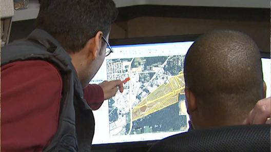
Geospatial analytics scientists assess, integrate, manipulate and extract data from Global Positioning Systems (GPS) and other databases to improve software platforms used in precision agriculture. They apply their knowledge of geospatial intelligence (intelligence about the human activity on earth from imagery and information that describes, assesses and visually depicts physical features on Earth) and multi-spectral images (images that capture data within specific wavelength ranges across the electromagnetic spectrum) to help enhance the health of farmers’ fields.
Future Job Market
-
Fair
-
Good
-
Excellent
Typical Employers:
Geospatial analytics scientists work for the government and for agriculture companies working on precision agriculture platforms, including agricultural equipment manufacturers.

Suggested Professional Organizations and Associations:
- Coalition of Geospatial Organizations
- International Society of Precision Agriculture
- American Society for Photogrammetry and Remote Sensing
- Geospatial Technologies Project
- State and regional information system associations
Salary:
$91,000?
SAE Connections:
What Responsibilities Will I Have?
- Plan, prepare and maintain maps and geographic representations to display layers and data
- Perform data analysis of multiple geographical data from multiple sources
- Be familiar with geospatial intelligence and multi-spectral images
- Plan, prepare and maintain maps and geographic representations
- Develop software platforms that enable cutting-edge research and development
- Develop research strategies for discovery projects in precision agriculture platforms
- Utilize the latest mathematical models to propose precision solutions
- Design and test algorithms
- Critically evaluate data for quality measures
- Conduct prototyping to evaluate possible scenarios developing novel approaches to problems
- Work collaboratively with interdisciplinary scientists
- Communicate technical results in a clear, concise and effective manner with emphasis on data visualization techniques
- Develop new solutions utilizing mapping technologies
- Ensure that all data is properly documented and tracked
Recommended High School Courses:
- agricultural education, particularly agricultural mechanics
- biology
- earth science
- geography
- computer skills
- focus on higher level mathematics
Education/Training Required:
A master’s degree in agricultural engineering, environmental engineering, civil engineering, agronomy, mathematics/statistics, meteorology, computer science or geographic information systems is needed. A doctorate degree may be required for more senior-level positions.