
Cartógrafos y fotogrametristas
Los cartógrafos y fotogrametristas recopilan, analizan e interpretan datos geográficos para elaborar mapas que muestran el relieve, las fronteras y otras características. Crean mapas precisos utilizando tecnologías de cartografía, software SIG y sistemas de imágenes aéreas. En el ámbito agrícola, apoyan la toma de decisiones, como el diseño de la distribución de las granjas, la optimización de los sistemas de riego y el monitoreo del estado de los cultivos mediante datos geoespaciales.
¿Qué responsabilidades tendré?
- Recopilar datos sobre la Tierra mediante drones, dispositivos GPS y herramientas de teledetección
- Recopilar datos a partir de fotografías aéreas, notas de levantamiento y bases de datos SIG
- Crear mapas y modelos espaciales precisos
- Actualizar los mapas para reflejar los cambios en el uso del suelo o el terreno
- Determinar el contenido, el diseño y las especificaciones de producción de los mapas para orientar las decisiones
- Diseña mapas temáticos que muestren el suelo, los cultivos o los recursos hídricos
- Verificar la precisión de los datos cartográficos y corregir los errores
- Elaborar informes y documentación para proyectos de cartografía
- Colaborar con topógrafos, especialistas en medio ambiente y profesionales de la agricultura
- Mantener bases de datos con información geográfica y fotogramétrica
- Desarrollar herramientas de mapeo digital para la agricultura de precisión
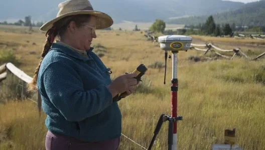
- Desplazarse a los sitios para verificar las características del terreno y recopilar datos de GPS
- Calcular el tiempo, los recursos y los requisitos del proyecto para respaldar las decisiones de planeación
- Asegurar el cumplimiento de las normas y regulaciones de cartografía
Cursos recomendados de la preparatoria
- educación agrícola
- geografía
- ciencias de la tierra
- arte
- Inglés
- matemáticas
- conocimientos informáticos
Formación académica/capacitación requerida
Por lo general, se requiere una licenciatura en geografía, cartografía, geomática, topografía o tecnología de sistemas de información geográfica (SIG). Los puestos de mayor responsabilidad pueden exigir una maestría, especialmente en el ámbito de la investigación o en aplicaciones especializadas de fotogrametría.